
Hiking in Bulgaria: Rila, Pirin & Rhodope Trails
Hiking in Bulgaria explained: Pirin for scrambling, Rila for big alpine days, the Rhodopes for forest trails. Marking system, huts, rescue and season.
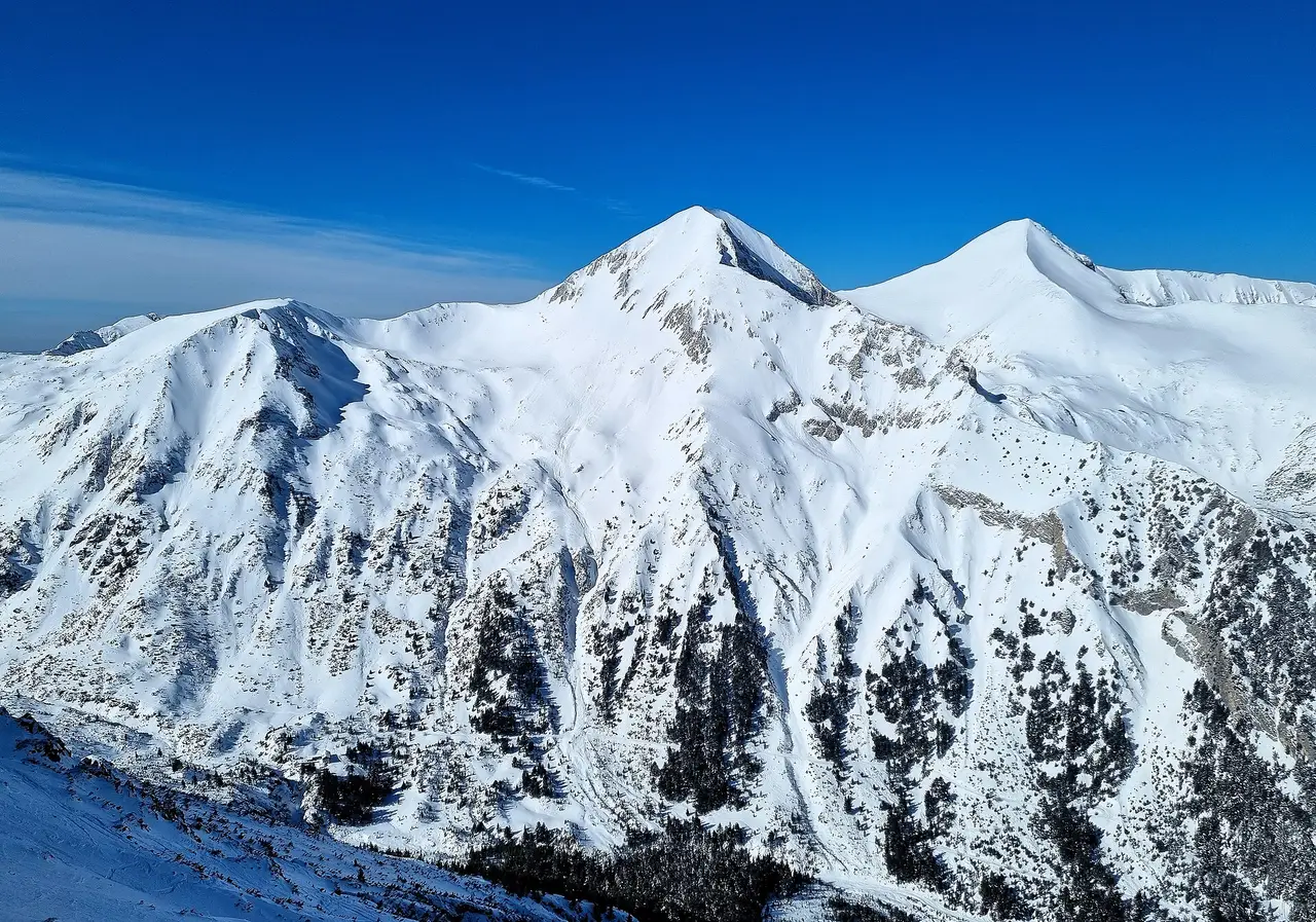
Bulgaria’s hiking splits cleanly into three ranges, and picking the right one matters more than picking the right trail. Pirin has the scrambling and the exposure, with a knife-edge ridge that stops people in their tracks. Rila has the big, non-technical days and the highest peak in the country. The Rhodopes are gentler, forested and forgiving, the range you pick when you want a proper walk without the adrenaline. The high routes clear of snow by around mid-June and can see the first falls by October; the Rhodope trails sit lower and stay walkable for longer on both ends of that window. All three are looked after by mountain rescue volunteers you hope never to need.
Bulgarian trails are marked by colour, not by difficulty, and that one distinction trips up a lot of first-time visitors. A red-marked route and a blue-marked one aren’t ranked against each other the way a piste map ranks a black run against a blue one. The colour just identifies which path you’re on; a red trail can be an easy valley stroll, and a blue one can climb into genuinely rough terrain. Read the route description, not the paint on the rock.
How the trail-marking system actually works
Pirin National Park alone has 27 officially marked pedestrian trails, each a different length and difficulty, with a combined length the park directorate describes as several hundred kilometres. (If you meet an older list of 22 routes in Roman numerals, you’re reading the directorate’s retired website; the current one counts 27.) The backbone runs Predel hut - Yavorov hut - Vihren hut - Tevno Lake shelter - Pirin hut - Popovi Meadows, carries a red mark, and forms part of the international E4 long-distance path, of which the directorate puts 47 km inside the park. Another marked route links Bansko via Bunderitsa to Vihren hut and on to Yane Sandanski hut. The numbering and marking are set by the Pirin National Park Directorate, and the same destination is often reachable by more than one marked path, so two hikers can start from different huts and meet at the same lake.
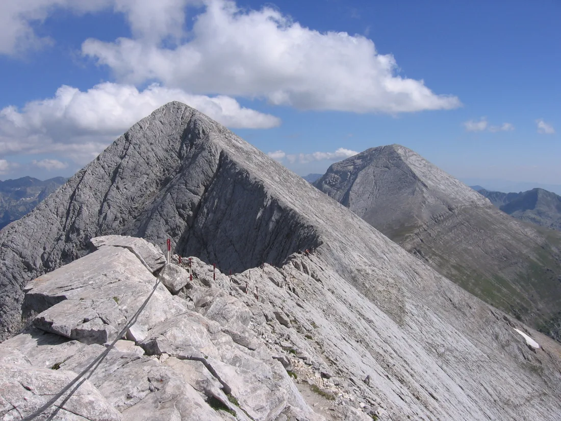
The E4 through Bulgaria (sometimes called the Five Mountains route) crosses Vitosha, Verila, Rila, Pirin and Slavyanka, starting at Dragalevtsi on the edge of Sofia and ending 260 km later at Gotsev Vrah on the Greek border. Its highest point is Vihren, and its most famous stretch is Koncheto, “the Little Horse”, a narrow ridge above 2,800 m with near-vertical drops on both sides and fixed cables for the exposed sections. Walked end to end, it’s traditionally a two-week trip for a moderately fit hiker, 6 to 12 hours a day between huts. Most visitors take a far smaller bite: a day or two in one range, not the whole traverse.
Pirin: the technical range
Pirin is where Bulgarian hiking gets serious. Vihren, at 2,914 m, is the country’s second-highest peak and the range’s signature summit, and several marked trails converge on Vihren hut, the last stop before the top. From the hut it’s a red-marked path over the Kabata saddle, and published times put the climb at two and a half to four hours one way for 963 m of ascent - the hut sits at 1,951 m. The upper section is rocky scrambling with no shade, and you’ll be using your hands for the final push. It isn’t technical rock climbing, but it’s a different order of effort from a lake-side stroll, and plenty of hikers turn back once the exposure sets in.
If you’re driving up, there’s a restriction worth knowing about, and it runs in both seasons. Through the summer Bansko municipality bars private cars and parking on the road from Shiligarnika to Vihren hut for the middle of the day, 08:00 to 16:00 - in 2026 from 10 July to 15 September, in 2025 from 14 July. It doesn’t cut the hut off: the scheduled hut bus and taxis licensed by the municipality are exempt, so there’s a way up in those hours without your own car. Winter is stricter rather than looser - the same stretch shuts round the clock for months, and a second order can close the road below Shiligarnika once the ski car parks fill. The municipality reissues these orders every season, so check the current notice on its site rather than last year’s dates.
Pirin isn’t only Vihren. The park’s network of huts (Yavorov, Vihren, Bunderitsa, Sinanitsa and others) means you can string together multi-day routes without carrying a tent, and the lower valleys below Bunderitsa hold glacial cirques and alpine lakes that need none of the scrambling. It’s the range to pick if you want the country’s most dramatic mountain day and don’t mind earning it. For the UNESCO park angle, visitor-centre hours and the full trail count, see Pirin National Park.
Rila: the big, non-technical days
Rila is a different kind of mountain range. Musala, at 2,925 m, is the highest peak in Bulgaria and in the entire Balkan peninsula, and unlike Vihren it doesn’t demand technical climbing to reach, just a long day with real elevation gain. Malyovitsa, at 2,729 m, is the high point of the E4’s Rila stretch and one of the range’s most popular bases, with its own hut and a dramatic north face for anyone who’d rather look up than climb.
Rila National Park was established on 24 February 1992, and its trail network covers hiking, mountain biking, rock climbing and pilgrimage routes alongside the walking paths most visitors use. The park’s best-known hike by far is the Seven Rila Lakes: a lift from Panichishte handles the first stretch of climbing, then a walking loop threads between the lakes themselves. It’s popular enough, and detailed enough on transport, prices and timing, to earn its own full guide instead of a rehash here - that’s the one to read next if you want one big, achievable alpine day with a lift doing the hard climbing for you. If you’d rather drive the whole loop, Rila also anchors our seven-day Rila and Rhodopes road trip, which threads the monastery, the lakes and both mountain ranges into a single car itinerary.
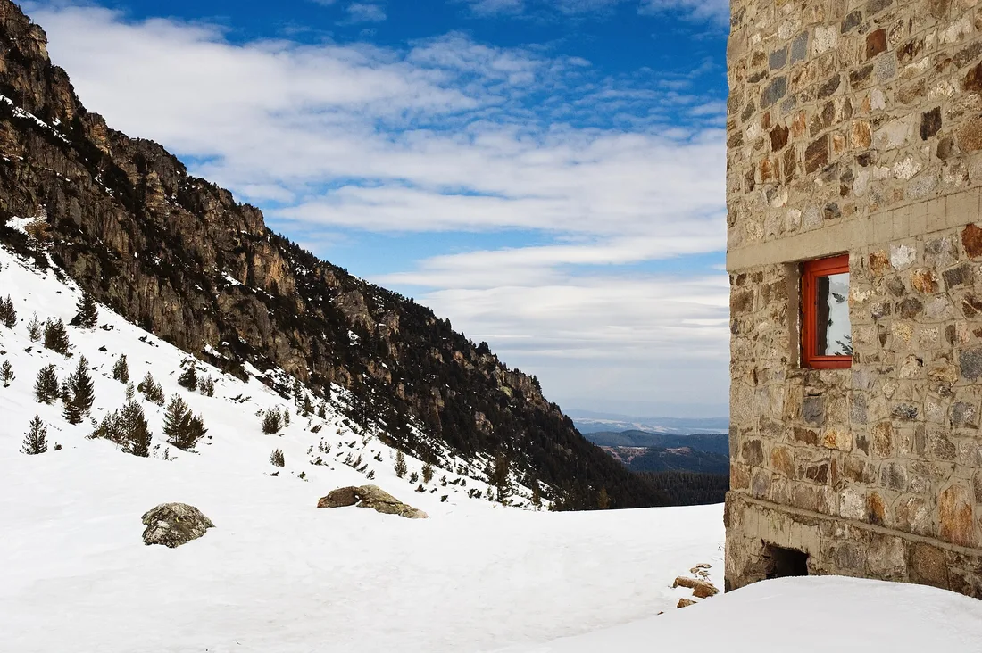
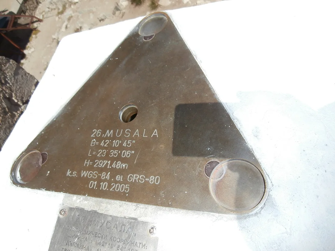
A detail worth knowing if you’re already planning a ski trip: the same Yastrebets gondola that carries skiers above Borovets in winter runs in summer too, and it’s the easiest way to start a Musala day without walking up from the valley floor. It’s an easy shortcut to miss if you don’t already think of Borovets as a ski resort, and an obvious one if you do. Our climbing Musala guide covers the gondola’s summer schedule and price, the real hiking time from the top station, and the two huts and the weather station on the way up.
The Rhodopes: the forgiving range
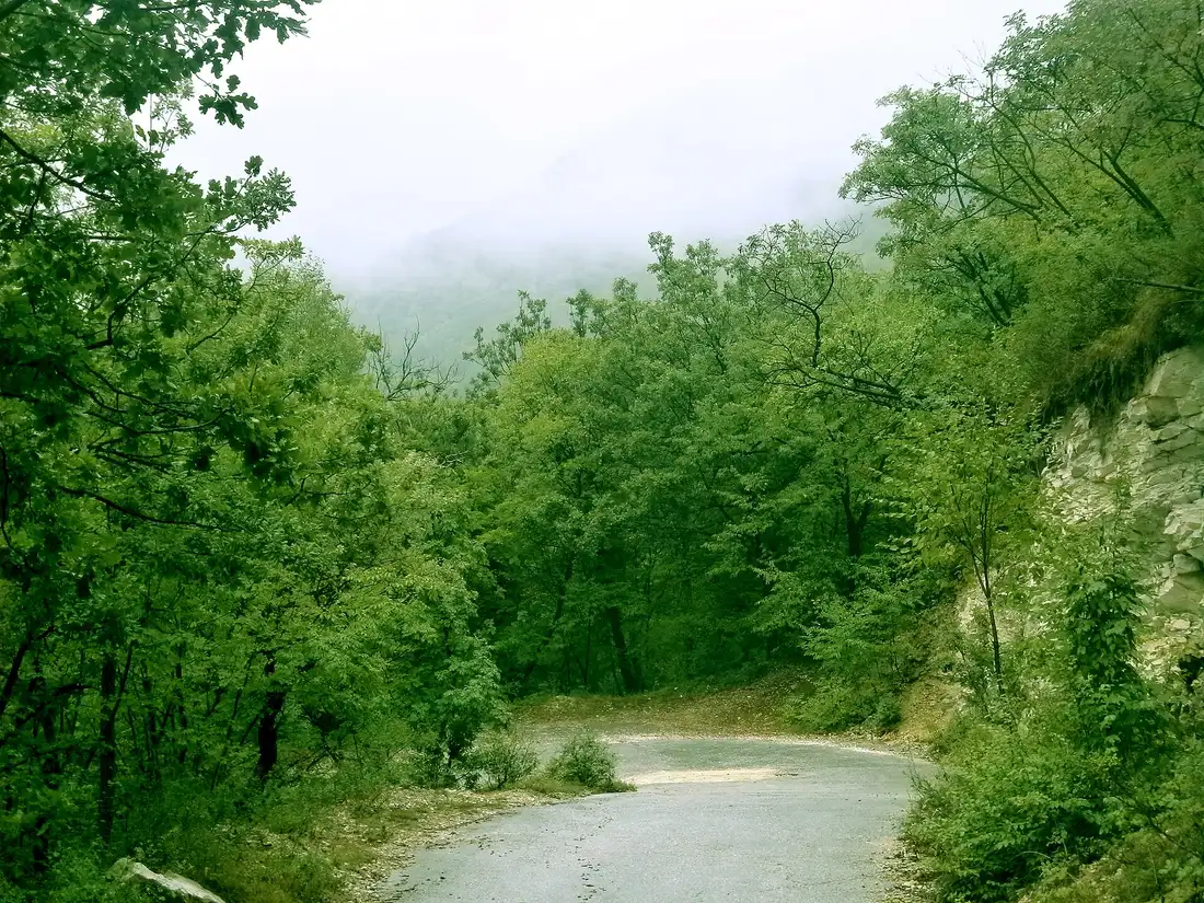
Drop south into the Rhodopes and the whole character of the mountains changes. There’s no single Rhodope National Park directorate running one marked network the way Pirin and Rila have; instead you get a broad, forested, lower-altitude range where the trails run village to village rather than hut to hut. It’s the least technical of the three ranges and the most family-friendly, with long forest paths, quiet reservoirs and traditional villages that double as trailheads, Trigrad and Yagodina among them.
The showpiece underground detour here is the Devil’s Throat Cave near Trigrad, which has its own guide covering tickets, timing and the village itself, so we won’t repeat that here. Above ground, the Rhodope forest trails are the range to choose if you’re travelling with kids, if the Pirin scrambling sounds like too much, or if you just want a quiet walk through pine and beech rather than a summit push.
Huts, villages and where to base yourself
None of these three ranges expect you to carry a tent unless you want to. Pirin and Rila both run networks of mountain huts (hizhi) along their main routes, most with dorm beds and a kitchen serving something hot, and they’re the standard way to break a multi-day route into manageable stages. The Rhodopes work differently: you base yourself in a village, Trigrad and Yagodina again being the obvious ones, and walk out and back instead of hut-hopping.
For a shorter trip, most hikers use a town as their base and drive or shuttle to the trailhead each day. Bansko does that job for Pirin, Sofia or Samokov work for the Rila side, and the Rhodope villages work for themselves. Prices and availability vary hard by season, so it’s worth comparing live rates for your actual dates instead of trusting a season-old number.
Mountain rescue, weather and the safety numbers that matter
The mountains here are properly remote once you’re past the last hut, and Bulgaria’s mountain rescue teams - PSS, Planinska Spasitelna Sluzhba - cover Rila, Pirin, Vitosha and the ski areas, staffed mostly by volunteers. Being rescued isn’t automatically free if you’re not insured, and a serious evacuation runs into real money fast. We’ve already fact-checked the annual subscription cost and the wider insurance angle in our Bulgaria travel insurance guide; that’s the page to read before you set off, not a blog post. Here’s the one number worth repeating: dial 112, free from any phone, for an actual emergency.
Weather is the other real risk, and it behaves the same way across all three ranges: a clear morning can turn into an afternoon thunderstorm with startling speed above 2,000 m, especially in July and August. The pattern that works is starting early, being off any exposed ridge, Koncheto above all, by early afternoon, and treating a forecast that looked fine at breakfast as provisional by lunchtime. None of that is unique to Bulgaria, but the Pirin ridgelines make the consequences of ignoring it worse than most.
Getting to the trailheads
None of the three ranges are reachable by a single dependable bus service all the way to the trail. Bansko, the usual Pirin base, has bus and shuttle links from Sofia; the Rila trailheads are a mix of the Panichishte road for the lakes and less frequent services elsewhere; the Rhodope villages are the most car-dependent of the three. A rental car or a fixed-price transfer solves the same problem every time: you set your own start time instead of working backwards from a shuttle timetable, which matters when an early start is the difference between a clear ridge and an afternoon storm.
Rila, Pirin or the Rhodopes: pick by what you want from the day
If you want the country’s most dramatic single day and don’t mind exposure, that’s Pirin, and Vihren by way of Koncheto is the trip to build a holiday around. If you want a huge, achievable peak without technical climbing, Rila gives you Musala and Malyovitsa, plus the Seven Lakes as the easiest big payoff in the country. If you’re travelling with people who’d rather not scramble at all, or the forecast has turned, the Rhodopes will still give you a proper day out and won’t punish you for it. Most visitors end up doing a bit of two of the three; few manage all three ranges on one trip, and that’s fine. Pick the range that matches the day you actually want, not the one that photographs best.
Read also

What to see · 13 min read
Skiing in Bulgaria vs the Alps: Honest Verdict
Verified · September 13, 2026Bansko's last published 6-day pass was 341 EUR; Livigno's 2026-27 rate is 374.50 EUR. Real lift-pass, terrain and rental numbers, checked Sep 2026.

What to see · 12 min read
Pirin National Park: Vihren, Trails & Lakes
Verified · September 3, 2026Pirin National Park: the Vihren hut road closure, UNESCO peaks, 27 marked trails, glacial lakes and Bansko visitor centre hours.

What to see · 12 min read
Climbing Musala: The Balkans' Highest Peak
Verified · August 29, 2026Climbing Musala, the Balkans' highest peak at 2,925 m: the Yastrebets gondola schedule and price, the real hiking time from the top station, huts and gear.

What to see · 9 min read
Learning to Ski in Bansko: Schools & Lessons
Verified · August 25, 2026Bansko ski lessons: group and private prices in euros from official schools, Banderishka Polyana base, plus the lift pass you still need. Checked 2026.